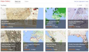
Google Inc. (NASDAQ:GOOG) is used by millions of individuals to help them with directions, in addition to viewing sites you wouldn’t normally have the opportunity to see. Now, Google has partnered with governments and informative organizations to offer Google Maps Gallery.
Interestingly, some of the routes listed include 1814’s Lewis and Clark trail, city escape routes and information on the world’s most endangered coral reefs. The maps come from a variety of sources such as World Bank Group, National Geographic and the US Geological Survey.

Frank Biasi, National Geographic Maps director of digital development, states that, before this project, most of their maps were only available in paper form. Today, they can be accessed by anyone online. Biasi goes on to state, “Maps Gallery makes our entire collection and individual maps discoverable and viewable to the world through a simple Google Maps user experience.”
Google Maps Engine was launched last year, which enabled anyone to publish their maps through the platform. Maps Gallery is simply an extension of the Google Maps Engine. So, you have hundreds of years of maps that you can sort and search for anything your heart desires. It is akin to visiting a library or museum. Imagine learning even more about history than you had ever hoped to find. Put yourself in the shoes of some of the world’s most emulated figures, individuals who helped pave the way for our modern world.
The collection of maps can also be found on Google earth and through search engines. It is just another addition of all of the information Google gathers and offers the world.
For more Google news follow PFhub on FaceBook, Twitter or bookmark this page.


